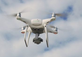

Researchers at the University of Georgia Skidaway Institute of Oceanography are using aerial drones to help measure erosion of the engineered sand dunes on Tybee Island.
Every five to seven years for the past few decades, the Army Corps of Engineers has pumped thousands of tons of sand onto Tybee Island to renourish beaches that are being reduced by natural erosion and the influence of the Savannah River ship channel.
“We know sand dunes are protective, and that building dunes is better and cheaper than building seawalls,” said Skidaway Director Clark Alexander. “The goal of our project is to determine how they function after you build them, and how they change so we can better manage them in the future.”
Alexander and his team are using drones and high-tech mapping technology to see how well the dunes stand up to the forces of nature. It takes four to five days for a drone to survey Tybee’s beaches, taking thousands of overlapping pictures. By comparing the results of the surveys over time, Skidaway researchers can monitor changes in the dune system.